Contact Info, Map & Boundary Information
Ali Lupal
WCDSB Communications and Community Engagement Lead
Email: [email protected]
ST. JOHN CATHOLIC SCHOOL – Arthur, Ontario
September 2003 (Reviewed April, 2015)
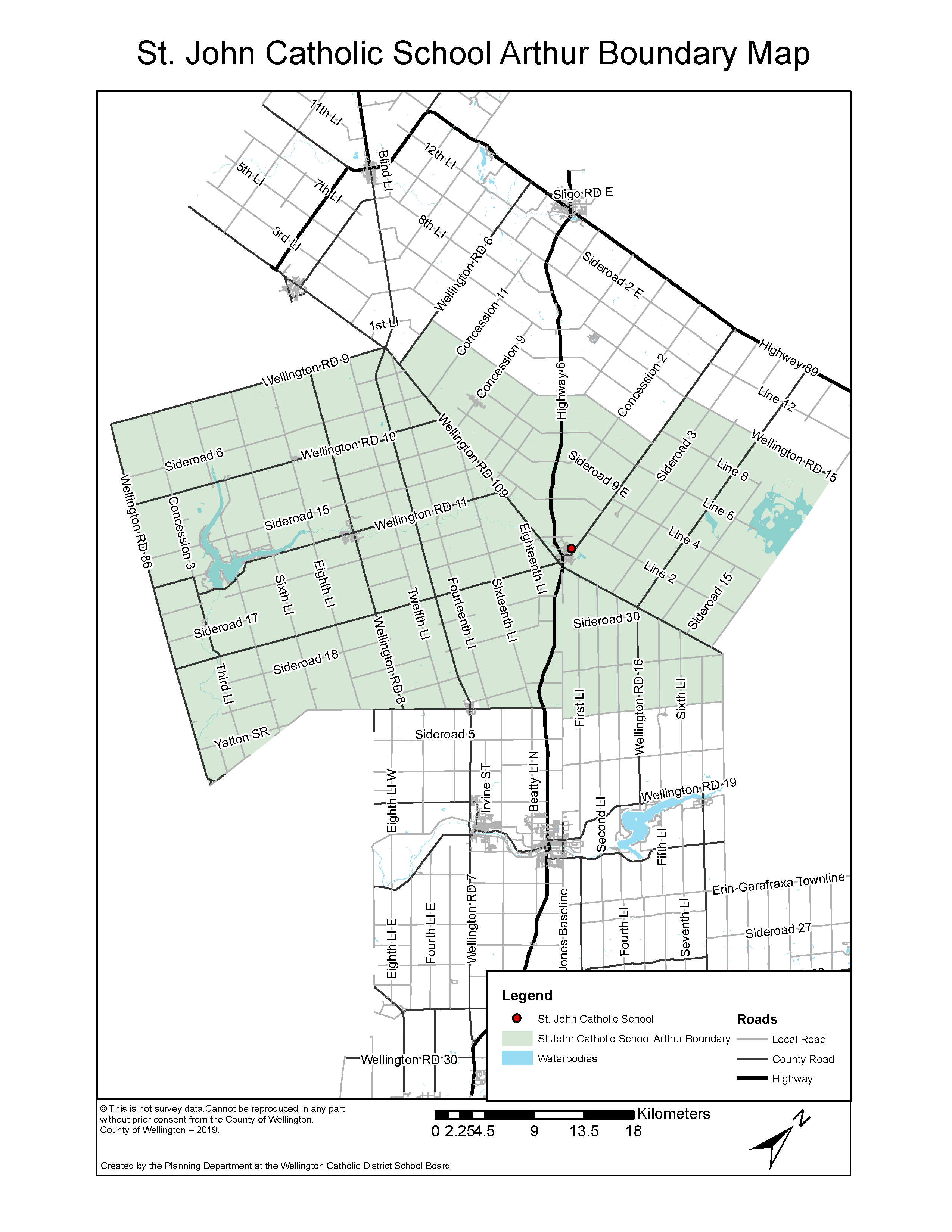
Area enclosed by:
Starting point: Wellington Rd. 9 @ Wellington Rd. 86
1. South on Wellington Rd. 86 to Wellington County-Woolwich Boundary Line / Reid Woods Drive
2. East on Wellington County-Woolwich Boundary Line / Reid Woods Drive (excluding Alma) to Yatton Sideroad
3. East on Yatton Sideroad to Floradale Rd.
4. East on Floradale Rd. to Wellington Rd. 17
5. East on Wellington Rd. 17 (excluding Alma) to Jones Baseline
6. South on Jones Baseline to Sideroad 20 (excluding houses on Sideroad 20)
7. East on Sideroad 20 (excluding houses on Sideroad 20) to East-West Garafraxa Townline
8. North on East-West Garafraxa Townline to County Rd. 109
9. West on County Rd. 109 to East-West Luther Townline
10. North on East-West Luther Townline to Wellington Rd. 15
11. West on Wellington Rd. 15 (Line 10 – both sides) to Wellington Rd. 14
12. South on Wellington Rd. 14 to Sideroad 7E
13. West on Sideroad 7E (both sides) to Wellington Rd. 6
14. South on Wellington Rd. 6 to Wellington Rd. 109
15. West on Wellington Rd. 109 to Wellington Rd. 9
16. Southwest on Wellington Rd. 9 to Wellington Rd. 86
17. Includes Town of Palmerston
Please Note:
1) Unless otherwise noted, the home school is the one on the same side of the street as the residence.
2) Boundaries are subject to change. Please verify with school or board office.